Harnessing data for risk assessment in agriculture
Harnessing data for risk assessment in agriculture
In December 2022, close to 200 governments signed the Kunming-Montreal Global Biodiversity Framework at the UN Biodiversity Conference COP15 (UN). Discussions shed light on the need to address potential cumulative effects of pollution and pesticide use in agriculture.
The Global Biodiversity Framework refers to taking a science-based approach to “reducing the overall risk from pesticides”. This aligns with a recent brief commissioned by the UN Convention on Biological Diversity (CBD) which suggests the adoption of environmental risk-based indicators in pesticide policies (UN).
Empowering farmers with geospatial insights
The International Food Policy Research Institute (IFPRI) reported that without new technology and adaptation by farmers, climate change could reduce global yields by up to 30 percent by 2050 (IFPRI). With food production needing to increase 70 percent by 2050, there is little time to lose (FAO).
Geospatial innovations could accelerate the transformation of the agriculture industry, contributing towards UN SDG 15 Life on Land by aiding accurate decision-making to minimize the use of pesticides and water.
For instance, geospatial monitoring provides greater access to data for farm management. Farmers can leverage real-time data and analytics regarding crop yield, water use and environmental conditions for various uses including:
- Monitoring crop health
- Creation of management zones
- Improvement of irrigation efficacy
Mitigating risk for finance resilience
Insurers could also benefit from geospatial data to estimate risk and productivity of farmland (AFR). Agricultural insurance can cover crop losses caused by natural events such as drought, and floods (Insurance Information Institute). The role of agricultural insurance will be crucial in limiting the exposure of the agriculture industry as increasing threats from climate change loom. Indemnity-based insurance relies on assessment of post-event crop loss to calculate the payout (ADB). At present, inaccurate estimations of the extent and intensity of crop damage can lead to miscalculations of pay outs given to farmers. Insurers could leverage geospatial tools to conduct pre and post-crop event comparison and calculate crop losses.
In the meantime, new measures of insurance are emerging, including parametric insurance which provide pre-determined payouts based on specific parameters such as rainfall index and soil moisture (Instech).

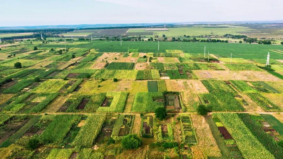
Bird’s eye view of farmland
Source: Freepik
Drought and flood exposure of Thai crops
Thailand is suffering its worst drought in years with below-average rainfall exacerbated by the arrival of El Nino on 4 July (WMO). Overall, the economic impact on Thailand’s agriculture and crops is estimated to reach between USD 0.3 to 0.9 billion (The Nation). For example, insufficient water in rivers and canals are limiting the growth of durian trees which then produce smaller fruits.
Thailand has national concerns regarding water quality which emerged as a result of urban and agricultural expansion. In 2022, Thailand saw its worst flood in years. 1,600 hectares of crops across more than 70 provinces were affected by the large-scale flooding event (The Straits Times).
Appropriate planning could limit flood damage in high risk areas. Researchers are now exploring the use of geospatial data for durian trees in plantations to identify areas with suitable conditions including weather conditions, nitrogen content and pH value (Mohidem & Kumaran).
In sum, by redefining pollution to include risk assessment and implementing risk-based indicators, we can increase momentum for producers to integrate ecological considerations into decisions and optimize location of growing regions.
Appendix
Target 7 of the Kunming-Montreal Global Biodiversity Framework (UNEP)
Reduce pollution risks and the negative impact of pollution from all sources by 2030, to levels that are not harmful to biodiversity and ecosystem functions and services, considering cumulative effects, including:
(a) by reducing excess nutrients lost to the environment by at least half, including through more efficient nutrient cycling and use;
(b) by reducing the overall risk from pesticides and highly hazardous chemicals by at least half, including through integrated pest management, based on science, considering food security and livelihoods; and
(c) by preventing, reducing, and working towards eliminating plastic pollution.
Important Information
This material is provided by Phillip Capital Management (S) Ltd (“PCM”) for general information only and does not constitute a recommendation, an offer to sell, or a solicitation of any offer to invest in any of the exchange-traded fund (“ETF”) or the unit trust (“Products”) mentioned herein. It does not have any regard to your specific investment objectives, financial situation and any of your particular needs.
The information provided herein may be obtained or compiled from public and/or third party sources that PCM has no reason to believe are unreliable. Any opinion or view herein is an expression of belief of the individual author or the indicated source (as applicable) only. PCM makes no representation or warranty that such information is accurate, complete, verified or should be relied upon as such. The information does not constitute, and should not be used as a substitute for tax, legal or investment advice.
The information herein are not for any person in any jurisdiction or country where such distribution or availability for use would contravene any applicable law or regulation or would subject PCM to any registration or licensing requirement in such jurisdiction or country. The Products is not offered to U.S. Persons. PhillipCapital Group of Companies, including PCM, their affiliates and/or their officers, directors and/or employees may own or have positions in the Products. This advertisement has not been reviewed by the Monetary Authority of Singapore.
